Details
Object ID 000019
Object Name Borden Map of Wallkill
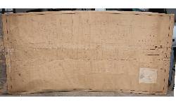
Object Desc Map of Wallkill drawn by Borden who designed the street layout the way he wanted the town to look
Collection Borden Map
Accession # 2016.1.1
Alternate ID
General Category Maps
Category Maps - General
Source Town Hall floor
Source Category Found
Accession Date NOV 19,2016
Credit/Acknowledgement Carolyn Crowell
Location Knights House
Object Date 1883
Start Year Range 1883
End Year Range 1883
Status On Exhibit
Object Keywords 2016.1,
Title Borden Map of Wallkill
Sub-Title
Edition
Area / Region New Area or Region
Maker
Maker Details
Publisher
Publisher Details
Language
Width 0
Height 0
Unit of Measure
Medium
Scale
Longitude East
Longitude West
Latitude North
Latitude South
Meridian Used
Other Details
Conditions
Events
Date NOV 19,2016
Summary Status change
Notes Status changed to On Exhibit from On Exhibit - automatic entry by System User
Date NOV 19,2016
Summary Location change
Notes Location changed to Crowell Barn from Crowell Barn - automatic entry by System User
Date NOV 22,2016
Summary Location change
Notes Location changed to Knights House from Crowell Barn - automatic entry by admin


