<click for bigger picture>
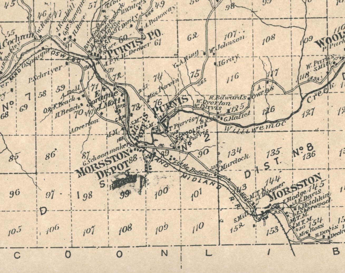
From Fred - My guess, and it is only a guess, is that the building that we are calling the Zieley residence is in the area of the Bennet place, which today is the last structure before the Route 17 overpass along Old Route 17, or earlier called the Roscoe Road by some sources.
On the 1875 Beers map [Now in the map section], the residence marked "Mrs. Purvis" would be in this area.
<click for bigger picture>
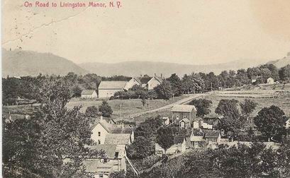 On the LM site, the page that's titled "On The Road" shows the Jacktown Hill sometime after 1905. The buildings in the far distance, the far right side of the image, would be in this area also.
<click for bigger picture>
 In the Emerson Bouton collection, volume 6, page 16, photograph number 197 shows Jacktown during the 1890's. The large white house on the heights overlooking Jacktown, right center of the image, would be the Rice house, or earlier the Kortright house, or, as shown on the Beer's map, the Hodge house. Just to the right of this house and in the distance you can see a portion of a building's roof. This building would also be in the general area. That barn that shows to the right of the Rice house and across the highway would have been located just this side of the Robert's structure that was built in 1915. This barn was located next to what is today's Emory residence.
So, was the Zieley residence the Bennett place? Maybe. The building itself, by its simple architecture, would probably date back to the latter 1800's. But you always need to be mindful that
catastrophic events may have altered or eliminated buildings in this area. Also be aware that the construction of the four-lane moved and eliminated buildings. But, at the moment, until other evidence states otherwise, my hunch is that this would be the area of the Bennett site, and maybe the Bennett house itself. For any certainty, deed work, title searching as well as plotting the metes and bounds, would need to be done for this lot. Is there any plot description at all on the Purvis deed?
fred