Questions and Comments
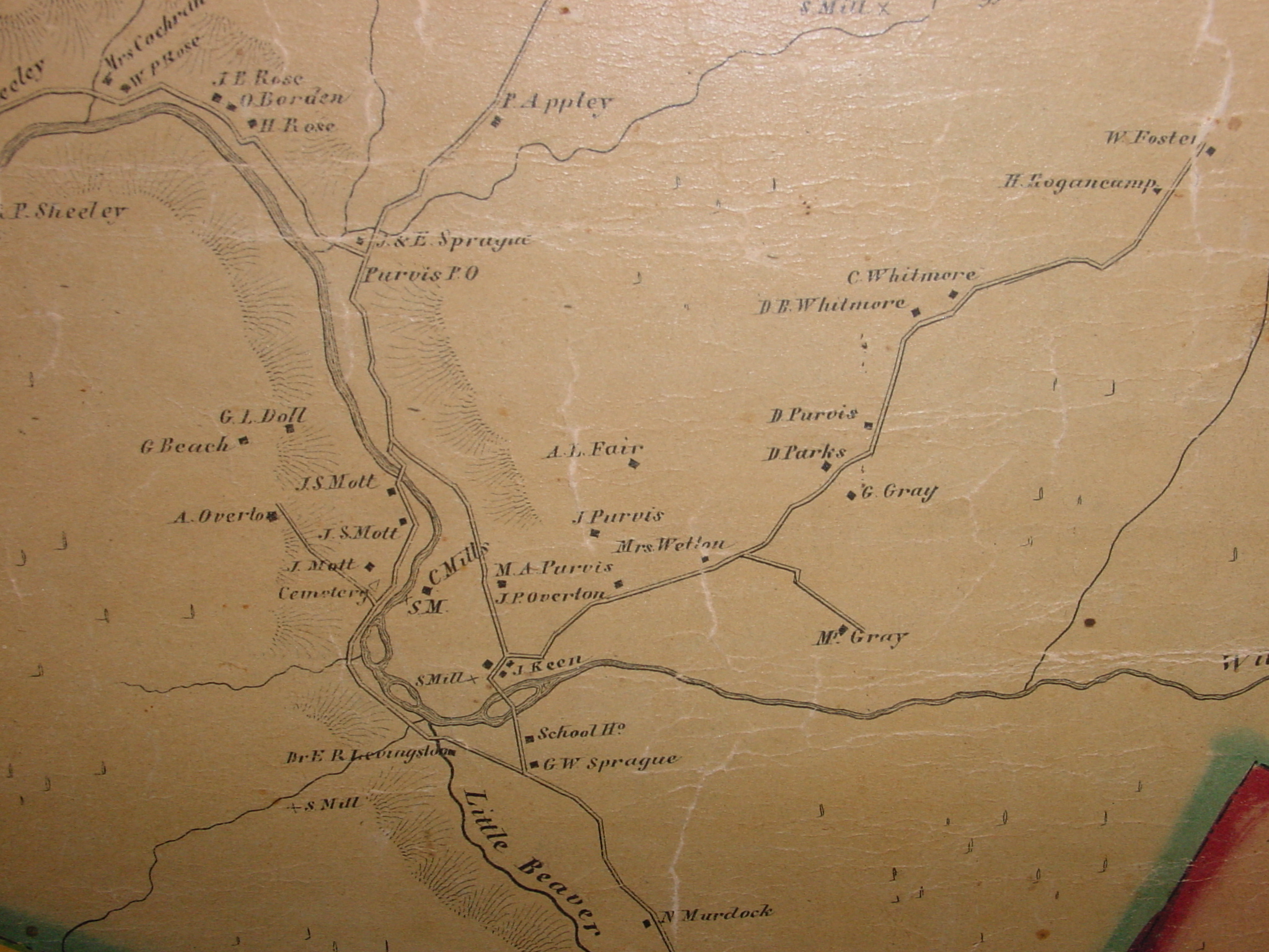
- Edward Livingston's house is show where the Hoos building is now. Either this is a mistake or his house wasn't at the location of the current Fire House
- No buildings are shown in the location that George Purvis received land from Edward Livingston's Father
- The DeBruce road wasn't built yet past the WhiteRoe road turn-off
- J.P Overton is shown on the White Roe Road and later in 1875 is shown on the DeBruce Road
- A road runs from the White Roe Road to M. Gray - This looks to be the loacation of the Edwards farm past the location of the old Sunrise Hotel
- D Parks is shown living on this road next to D Purvis. This looks to be at the top of the hill. This is likely to be a brother to my Great-Great Grandfather and married a Sarah Overton whose father J.P Overton lived where Fred Emery is now.
- An interesting point - David Parks and Cornelius Parks (brothers) married Sarah and Hester Overton (Sisters)
- The White Roe Road ends at Hogancamps and doesn't go to Grooville yet <click on map to see more>
- G W Sprague is at the corner of Rock ave and Pearl St. There are no other buildings to the South of the Willowemoc. Is this because Livingston didn't sell any of the land yet?
- Who is A. Overton that lived on Mott's flat? Is this Alexander Overton James P. Overton's brother. Where is David Overton (their father) living since he lived to be 94.
- Was the J. P Overtone farm the original farm that James Overton Sr. was neighbors with M. A Purvis (Manley) and the original farm of Settler George Purvis.
- Sullivan County Historical Society in Hurleyville is interesting and everyone should go - that's the source of this map and Fred is well-known there.
Harold