Parkston - mystery solved
Parkston NY - The earliest information about Parkston is in 1865 when P.H. Woolsey and Henry Lowe contracted with William Parks to cut lumber. William Parks owned several hundred acres in Parkston including the Barnhart/Lacey farm and the Hotel Capitol lot. He had built a sawmill and pond that later became the pond for Hotel Capitol.
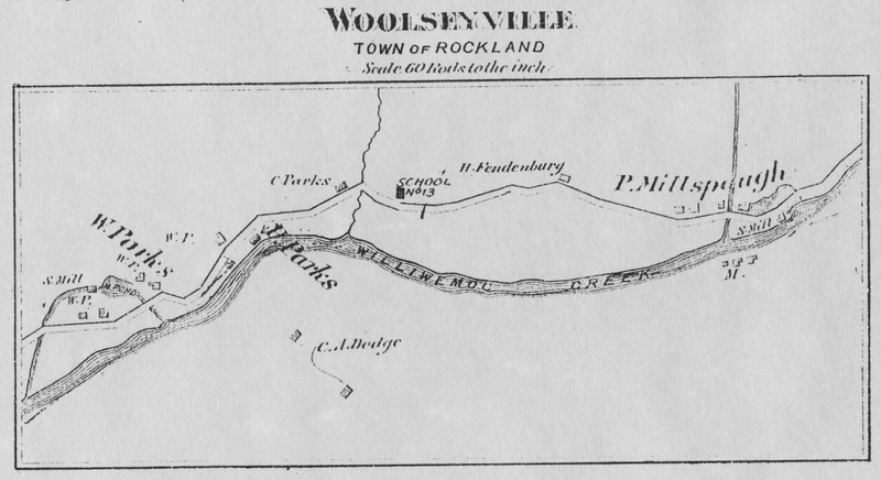
The Beers 1875 map shows William Parks sawmill and houses in most of Parkston. The next lot is the brother Peter Parks lot that later became the Hotel Lorraine Hotel. The next lot was brother Cornelius Parks.
Note the two buildings to the right of the smaller pond above the sawmill. It is suspected that William lived in these house and barn and his father Joseph lived in what became the Barnhart/Lacey house.
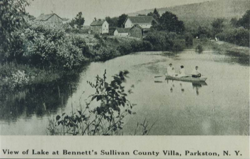
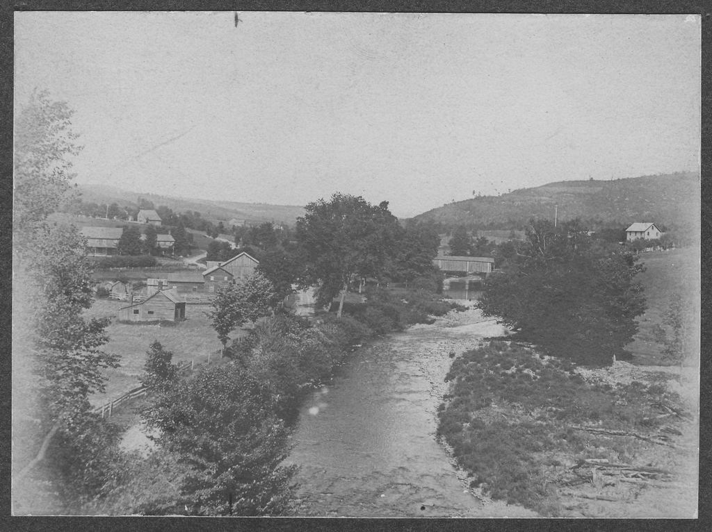
This picture shows the houses, barn and ice houses just above the sawmill pond where the boat docks were for the Hotel Capitol.
The DeBruce road can be seen in the distance by the inlet for the pond. Note the small building in the center with the 3 windows and the large 2-story building to the right that was probably the Bennett's Villa (probably bought from William Parks estate after 1891).
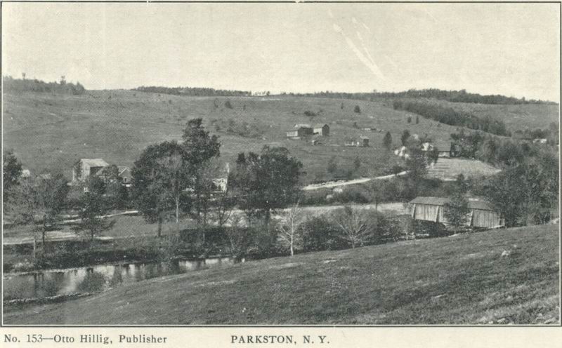
This overview of Parkston shows the covered bridge and in the left center the two buildings above the pond on the 1875 beers map and on the Bennett postcard.
A third building can be seen through the trees. This building sits right next to the raceway for the pond.
The Peter Parks house and farm are in the center of the picture with the barn that was still standing when I was a kid is.
The building on the far right is the Cornelius Parks house.
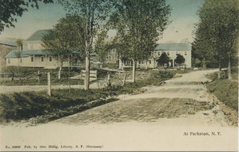
A view up the DeBruce road shows the new house on the left next to the raceway and the other buildings on the right. Note the building with the 3 windows that shows up in earlier pictures.
The picture was labeled the Parkston PO but was taken in front of the Parkston Post Office that was occupied by the George Barnhart family after William Parks died.
This shows the William Parks Farm that later became the Barnhart farm and
Parkston Post Office. The building in the lower left looks to be an old
house (2 chimneys). This is possibly the first house built in Parkston by
the Parks. It is on the location that later became a shed and garage.
The house above was the Post Office when Barnharts lived there and
later the Laceys. The house burned in about 1935 and was rebuilt by the
Lacey family. The large building next to that is a mystery but was probably
part of the William Parks farm and turning mill. Possibly it was used to
season the turned wood products.
The two buildings on the left can be seen in the picture above this and were
probably built by William Parks.
To the
right of the covered bridge is the Sturdevant house.
The age of the photo can be estimated by the size of the trees along the road. They look to be about 3-4 years old and were planted by my Grandmother Lillian Barnhart Lacey and her father when she was a little girl about 5 or 6. She was born in 1882 so that would make the picture taken in about 1890.
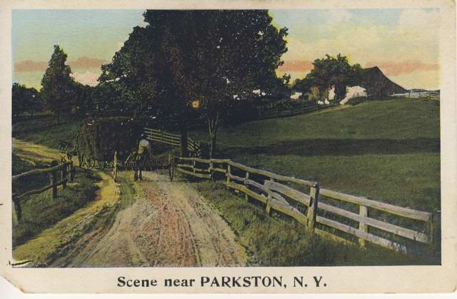 Scene
near PARKSTON - Anybody have an idea where this picture could have been
taken near Parkston. Based on the shadows the hay wagon and rake was
traveling West which could be the DeBruce road towards Livingston Manor.
Scene
near PARKSTON - Anybody have an idea where this picture could have been
taken near Parkston. Based on the shadows the hay wagon and rake was
traveling West which could be the DeBruce road towards Livingston Manor.
Barn from "Upper Parkston" Farm - Jan Sturdevant Carlson
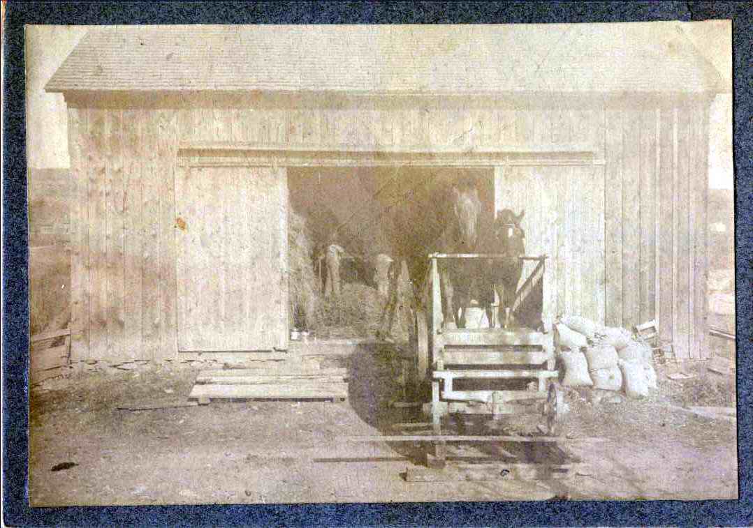
This looks to be the barn of my Great-Grandfather Frank Van Aken. The barn
used to be on the lower side of the road opposite the boarding house and one
room schoolhouse. The small white building in the far right is probably one
of the buildings of the Parkston House. The date of the picture would be
about 1900.
The horses are operating a thrashing machine that is separating wheat from
the buckwheat lot at the top of the hill. Later and addition to the barn was
added to the left and a silo on the right.
The barn roof collapsed from snow in 1992 and was torn down. (Now I wish we
had restored it) - Harold
Fred brought up the position of the sun - based on the shadows the barn is facing South which means it is not my GretGrandfathers barn and is probably the barn that was part of the Sturdevant's farm on the corner of the Kenmore road above the Sturdevant House. - Harold
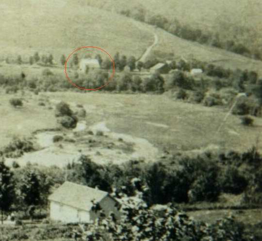
The building circled in the picture to the left is where I think the barn in the above picture is located across the valley. The picture was taken in about 1896 in back of the Van Aken homestead with the one-room schoolhouse on the bottom in front of the DeBruce road. I think this is the building just to the right of the barn in the picture above. The Parkston bridge over the Willowemoc is to the right. The road in the upper center is the road to Beaver Lake. - Harold