LM-Overview-North
<move the mouse around the picture to find names of objects>
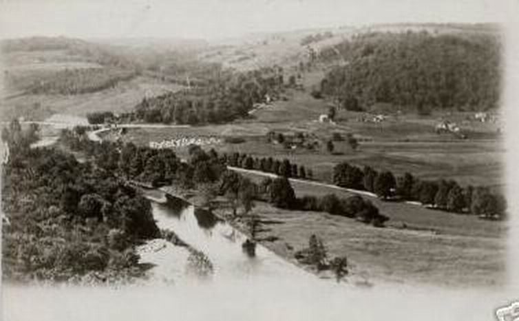
The photograph must be 1913 or later; the dug way along the newly built
Creamery Road still looks like a fresh cut and the railroad overpass is also
erected. Mott's Cemetery, which is to the right of the overpass is kind of
interesting in the matter of the number of headstones. There is nowhere
near that many today. To the right of the cemetery, within the cluster of
trees and along the railroad tracks are the J. Mott buildings that were
shown in the earlier picture taken from the overpass.
The white building above (behind) the J.Mott place, which is along the
Creamery Road, or Hazel Road, or whatever it was called, was the Ward house,
I believe Milt Ward. This house still exists today. The next to locations
are a puzzle without going out into the field and going over the site,
though the second one, those buildings closer to the railroad tracks may be
a lumber mill and yard that was set up about then. It later became the
location of the creosote plant. The last building on the right, may be the
residence of the Hauschild farm, which could have been the Overton place.
The only way to really verify this, though, would be to go to the county
clerk's office and research the deeds. It could possibly be that the Overton
place was where the Ward house is, or even the building next door.
Assessment records may also be of some help, at least for identifying the
properties around the date of this photograph. My next visit to the town hall
I'll do an assessment survey along this road to see if it provides any
information.
fred