Livingston Manor O&W Train and Stations
#243 Steam Train at Livingston anor NY in 1932
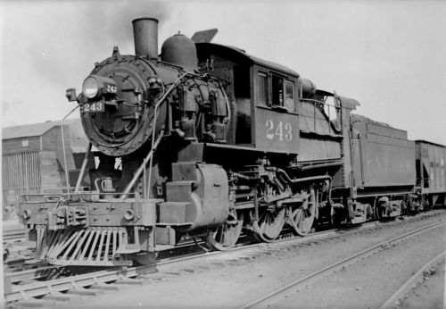
The question came up as to where the picture was taken. - Harold Van Aken
Though I do not have any photos of
that building, I have seen images of it and the building that shows in
the photograph looks similar to what I remember it to be. My guess is
that the photograph may be showing the Louis DuBois coal building. The
Manor station can not be seen as it is behind the locomotive and train.
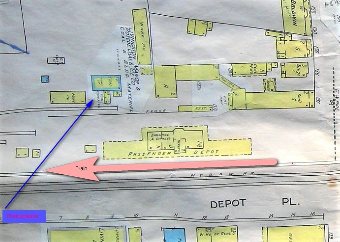
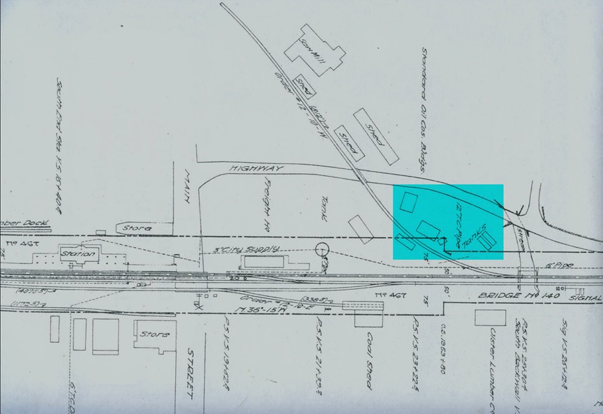
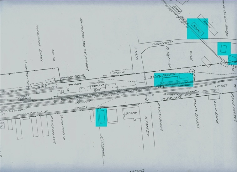
Sanborn Map of Train Station (looking towards Shandelee)
The Sanborn map shows the
section where Dubois Fuel was located. The date is about the mid
thirties. The building outlined in blue may be the same building.
When A P DuBois & Company ceased as a business,
Louis DuBois kept the coal fuel portion of the business. Originally
located on the Pleasant Street side of the tracks, he sold the business
to Sherman Ernhout, lumber dealer from Liberty. Louis Dubois later
bought out Hartig's building supply business and got back into the coal
business, as well dealing with heating oil. It was located across the
tracks from Erhout's Livingston Manor Lumber, behind what later became
known as Fried's general store. It is now part of the property owned by
the fire department.
_______________________________________________________________________________________
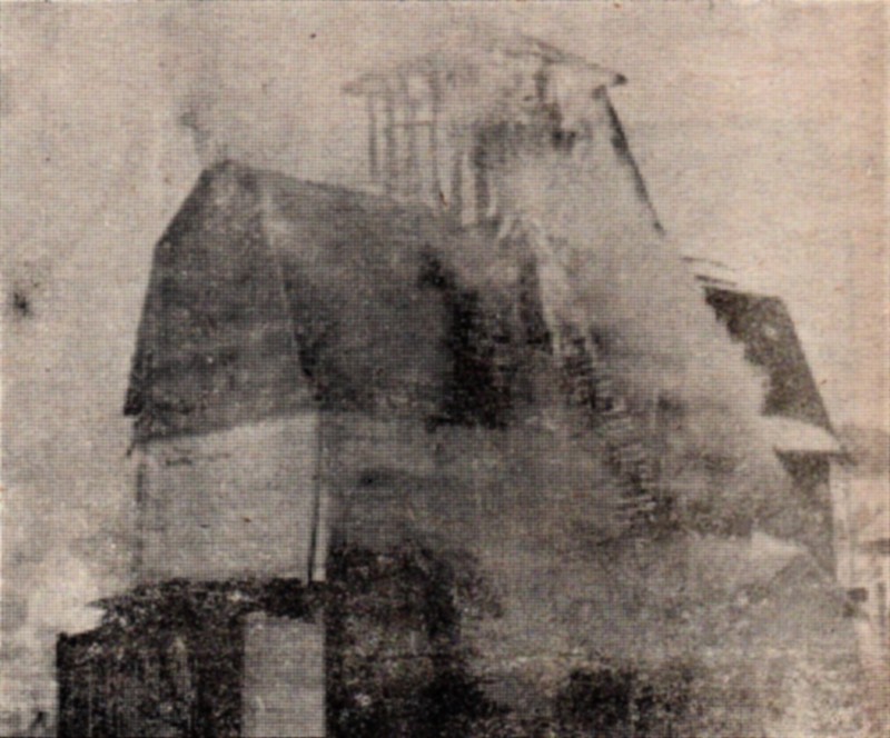
DuBois Coal Building Burning
NY Onterio & Western RIP
The New York, Ontario and Western Railway, more commonly known as the O&W or NYO&W, was a regional railroad with origins in 1868, lasting until March 29, 1957 when it was ordered liquidated by a US bankruptcy judge. The O&W holds the distinction of being the first notable U.S. railroad to be abandoned in its entirety.
The railroad began life as the New York and Oswego Midland Railroad, organized by Dewitt C. Littlejohn in 1868. Its mainline extended from Weehawken, New Jersey in the greater New York City area to Oswego, New York, a port city on Lake Ontario. It had branch lines to Scranton, Pennsylvania; Kingston, New York; Port Jervis, New York; Monticello, New York; Delhi, New York; Utica, New York and Rome, New York. The part south of Cornwall, New York was operated over the New York Central Railroad's West Shore Railroad via trackage rights.
When the O&W was liquidated in 1957, the tracks were taken up and sold for salvage
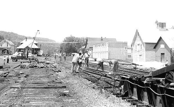
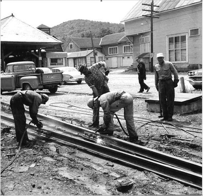
Station on the left and Fried's Store on the right
Sanborn Maps - Wikipedia
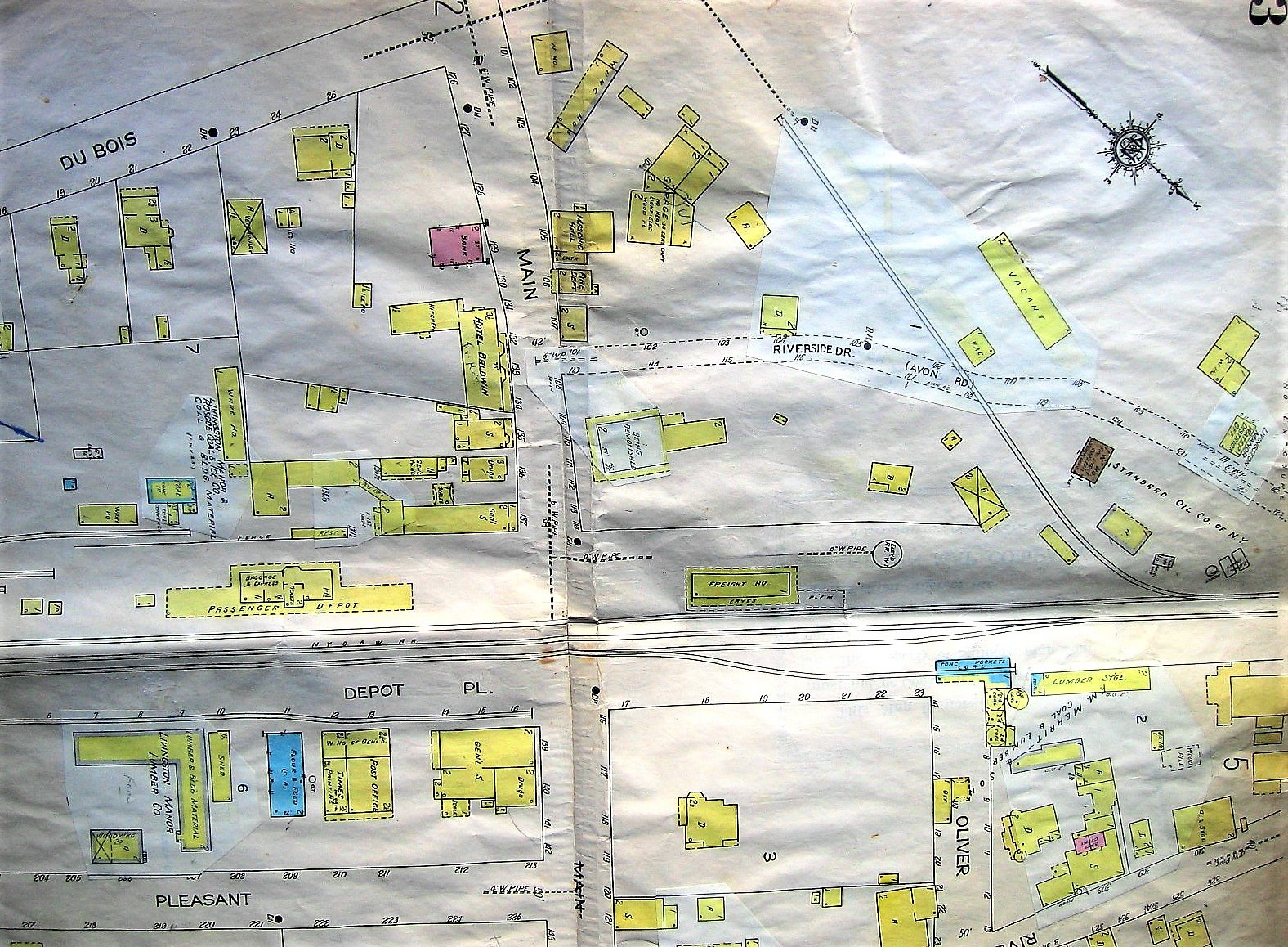
The full page Sanborn maps shows the area around the O&W tracks and buildings around the tracks . These maps were the property of James Curry, in relation to his father's and grandfather's insurance business. Dick Fredenberg acquired the map, and in turn donated them along with other items from the Curry family when James passed away. We credit Dick for the preservation of these maps and making them available to the public.
Fred
More Sanborn Maps
Harold Van Aken