<If you have questions, corrections or comments send to Harold Van Aken mail@hvanaken.com>
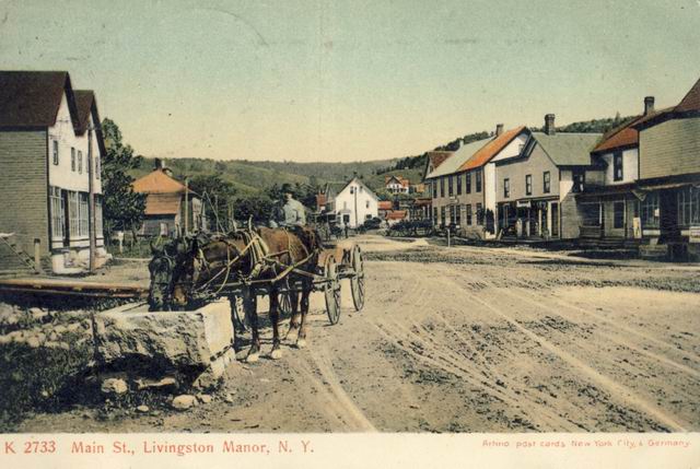
Center of town - Herm Gray from Grooville watering his horses in the watering
trough in front of what was
the Neuman building.
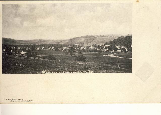
Note the Seigle building with the orange roof in the center right. Probably
about 1900
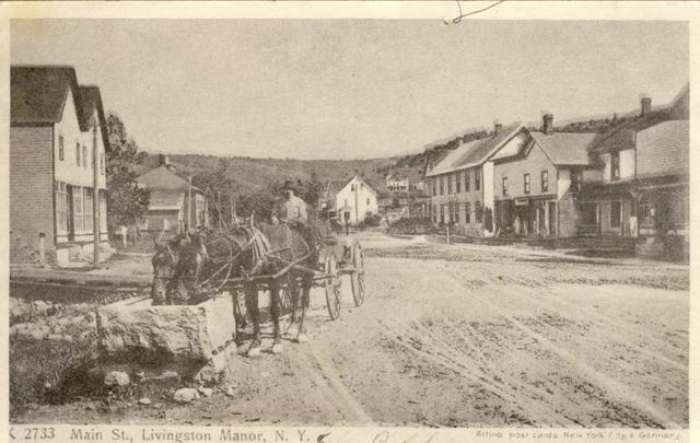
Same PIX but in B/W
DuBois Store - first sore in LM after the train came through town. Later was
Charlie Fuhrer Drug and
fountain store
Pearl Street with Denman house in the far middle right with the ornge roof
House on the right was probably the MA Denman House and later Mike Friedman
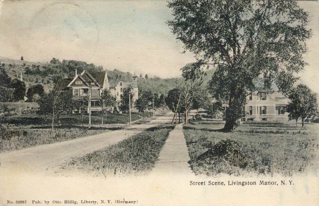
Earlier picture since the trees are smaller
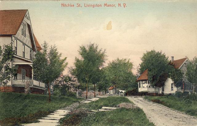
Nitchke Street. Living there all my life I had to go to google maps to find this street.
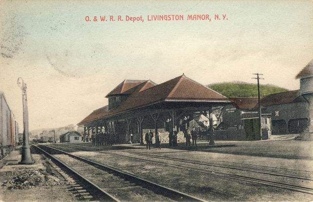
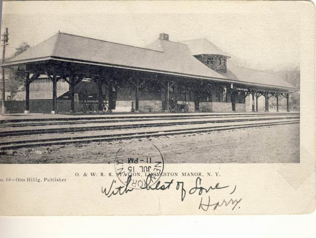
O&W Train Station. Note the double tracks
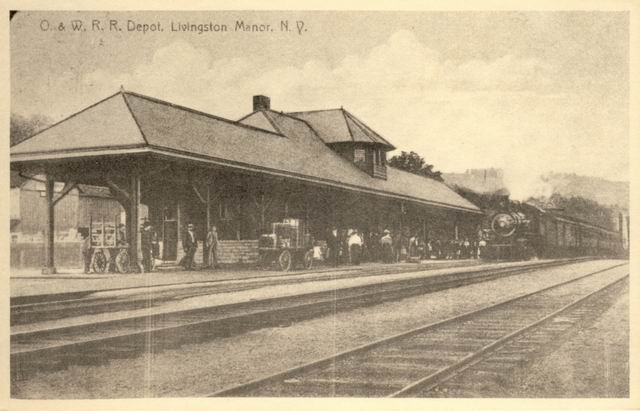
Another Station PIX
Probably and older pix of the "Station"
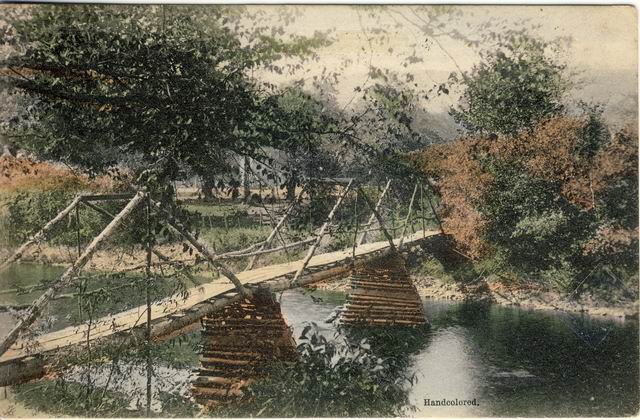
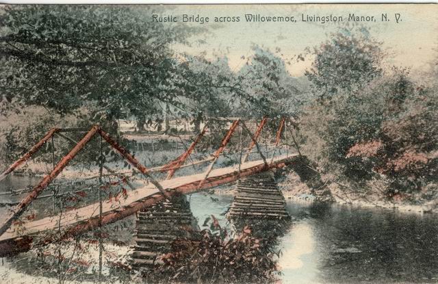
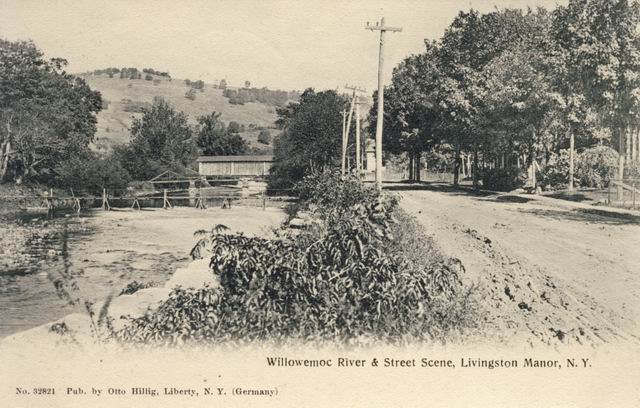
Footbridge across the Willowemoc to get to the "Island" about where the brigh to the LMCS scrool is now.
Same picture but in color
Covered bridge for Rt 17 covered bridge and a footbridge to the island.
Picture taken behind what later
became the Electric Service Shop
A little farther away showing Main Street and another footbridge to the island
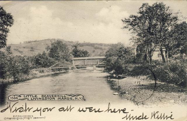
Duplicate of the first but from Uncle Willie
C
Covered Bridge looking NW. Buildings at the left are what later became a lunch and later Madison's
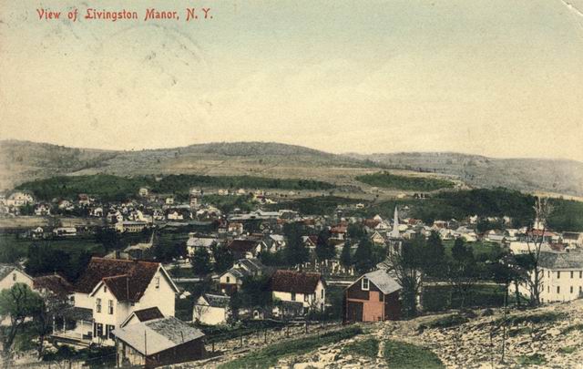
Overview of LM taken from behind the Presbyterian Church Cemetery. Steeple in the middle right is the Church
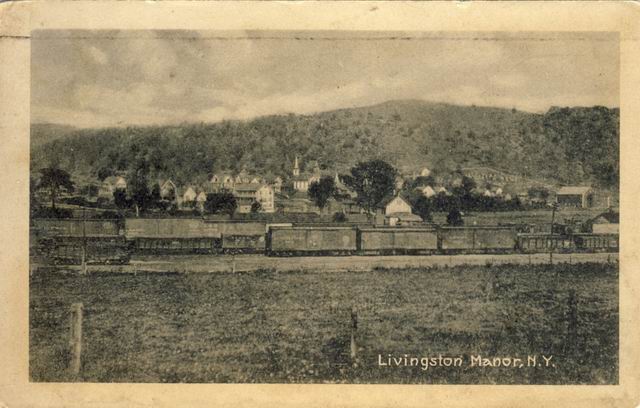
O&W train looking towards the Presbyterian Church. Denman House shown in the
middle left with the
boarding house on the right that burned shortly after it was built
Overview of LM Looking NE towards the farm on the hilltop that I can't think of
the name of
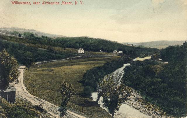
BeBruce Road and Willowemoc. Dave Wards house would be on the lower left.
White house in the middle
is probably the Bakery. Rt 17 bypass of LM went through about where the picture
was taken
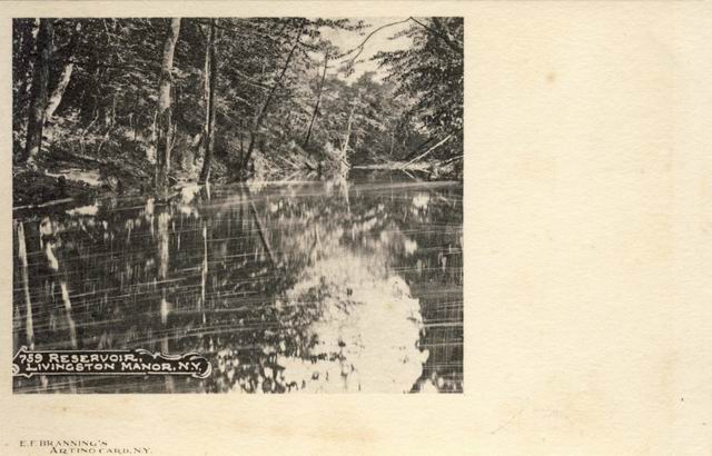
Not sure where the LM reservoir was. Could be the Cattail
Fred: located on the Hardenburgh Brook [near Morsston],
along the Dahlia Road behind the Ward homestead.
Not sure where this was taken. Candidates:
The flats but the Little Beaverkill river looks too far away.
West of Deckertown but the Willowemoc river looks too small and too far away
Anyone??
Fred: The flats between Morsston and Parkston. The
Little Beaverkill is on the right and a portion of the railroad bed can be seen
along its banks. The road is the State Route 4, old Route 17. The valley in the
distance would be Benton Hollow and the hill on the right would be a portion of
Fox Mountain.
Probably along the DeBruce road and maybe "Jack's Dam"
LM in the middle left looking East from Motts Flat. O&W on the right
Looks like the Willowemoc between LM and Roscoe below Deckertown Flats
Fred: Looking towards Mott's crossing, before being
replaced by the overhead crossing in 1913. The distant building near the center
of the image would be where the original crossing was. The railing along the
road to Mott's Flats can be seen above the tracks, beneath the telephone poles.
The photo was taken near Martin's Crossing, today the end of River Street.
No idea where this falls is. Anyone??
Fred: Morrston Falls; Sonoma Falls; behind the Bill
Staesser residence.
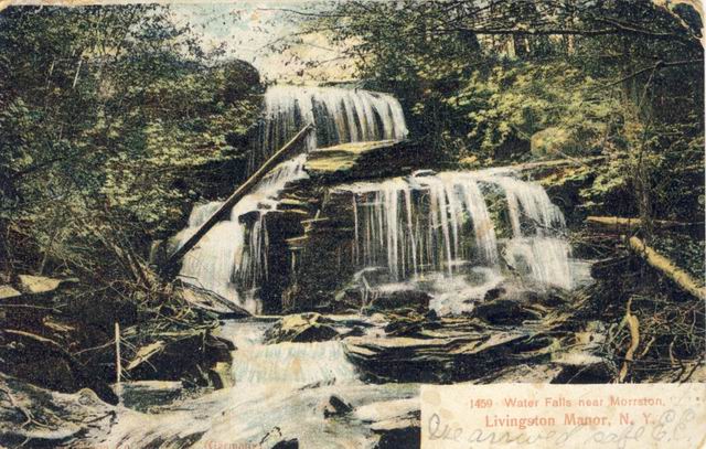
Same falls in color
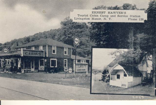
On the flats and was a gas station when I was kid. Bagley rings a bell and
maybe a pet bear or was that a dream
Fred: Alongside the current residence of John Krupp
along Old Route 17, but has been torn down about fifthteen years ago.
The tourist cabins were across the road, one used by the Roberts' a few years
ago as a boutique.
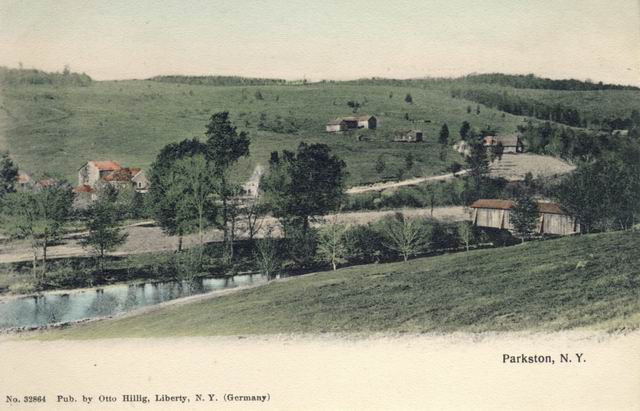
Parkston about the turn of the century. The Hotel Capitol and Hotel Lorraine
were later built on the hillside.
The buildings on the middle left were my Parks ancestors. The covered
bridge was in the same place as
the current bridge
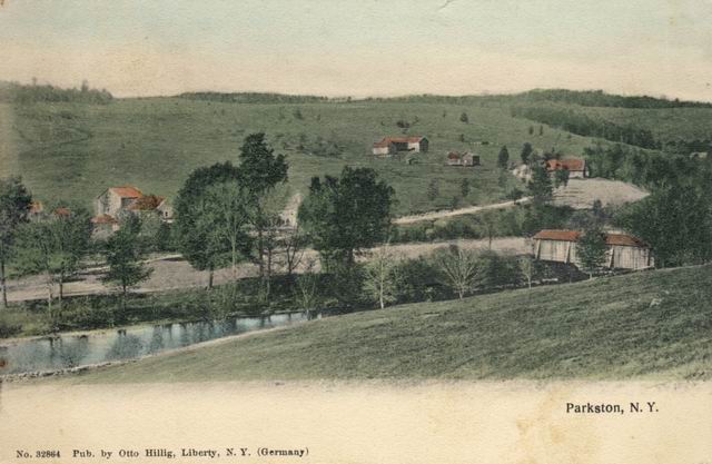
Duplicate
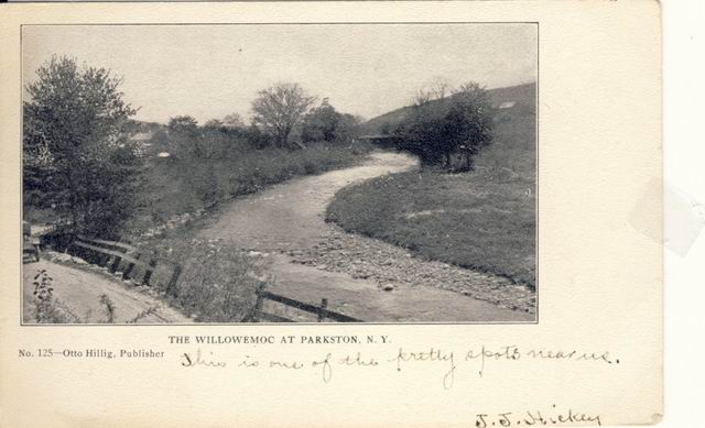
Parkston looking at the covered bridge ove the Willowemoc in the distance
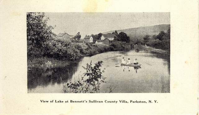
Bennetts Villa about 1900. Later was the Hotel Capital Pond. DeBruce road
crossed at the far end of the
pond. The building in the center were built by Parks and later the Hotel Capital
was built on the left
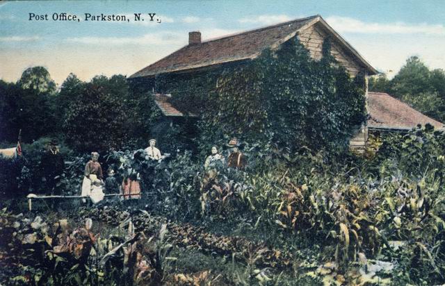
This was my Granfather Wiley Lacey's house and earlier my GreatGrandmother
Barnhart who was the
Postmaster in Parkston. The house burned in 1930 and was re-built and still
standing today. George and
Clifford Lacey lived their until they died. Grandfather Wiley is in the center
with suspenders.
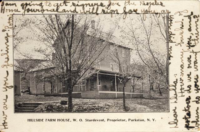
This was the Sturdevant House that later became the Parkston Hotel. He was the grandfather of Dick Sturdevant.
The Friedmans (Mike Friedman father) bought the Sturdevant farm and built the Parkston Hotel. It burned about 1959
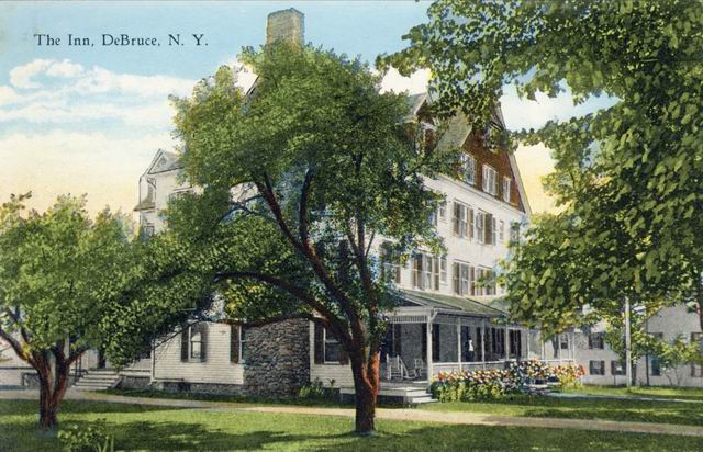
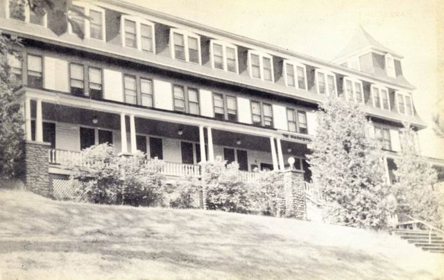
The DeBruce Club Inn. When I first moved to Livingston Manor my Mother worked
there as a waitress and
my Father worked at the farm that supplied food for the guests. This
building was the casino and still stands today.
Same building but showing more buildings
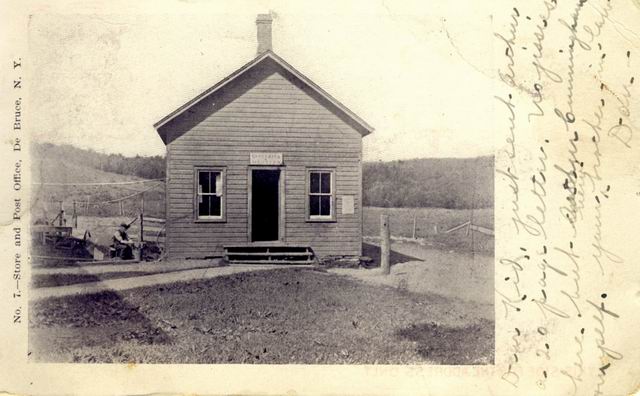
DeBruce Postoffice that later was a gas station and food store run by Mailon
Davidson. I remember going
there with my father for gas and BS. The store was added on the the left
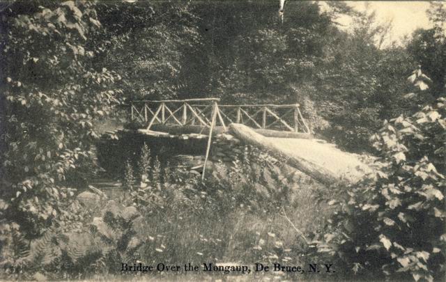
This was a bridge that went over the Mongaup just East of DeBruce and a short
distance from where it
joined the Willowemoc
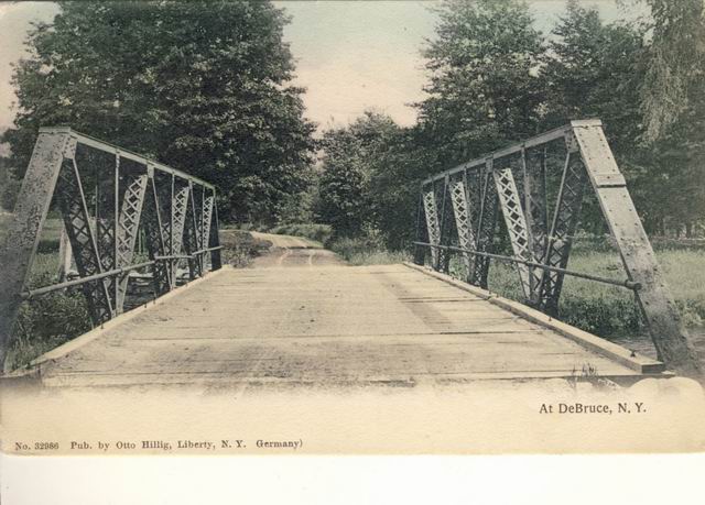
Not sure which bridge this is. Could be over the Mongaup or over the
Willowemoc on the way to ??? hill
that escapes me for the moment
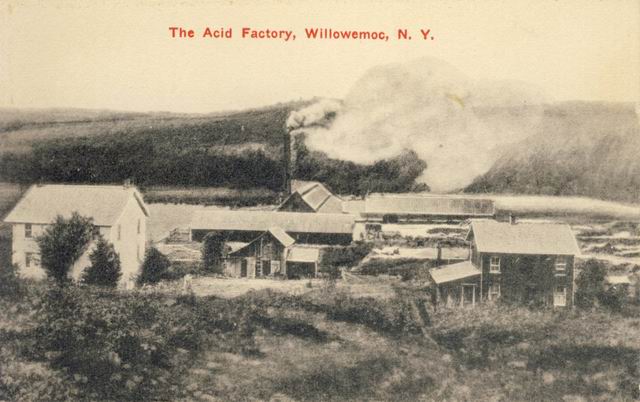
Acid factory in Willowemoc. Lots of early history here
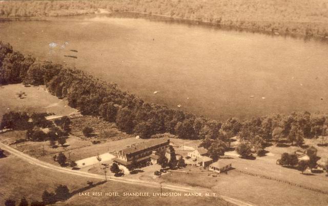
Lake Rest Hotel in Shandelee. I remember it well since I worked there when I
was 15 and my Sister
worked there when she was 17. Ed and Cathy Baker ran it when I worked there.
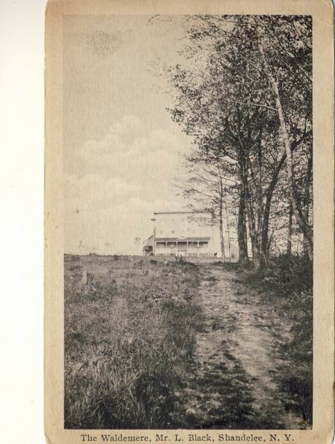
The Waldemere before it was a hotel. First time I saw this
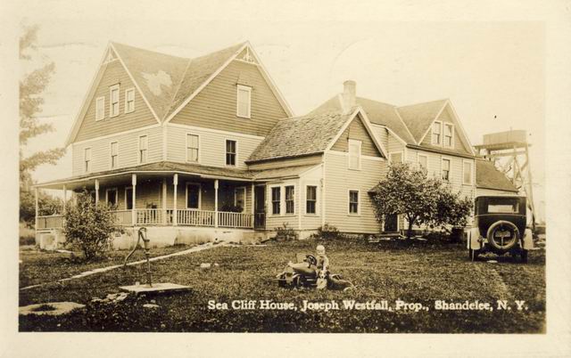
Sea Cliff House in Shandelee
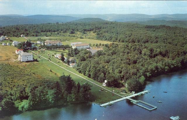
The Waldemere after it was a Hotel. Lots of early Sunday morning golf matches
there. Last one to Odies
at 7 AM Sunday had to pay for breakfast. Many times we went right from the bars
to golf. Denmans
, Simpsons, Wolcott and others. Seems Jim always had to pay.
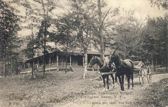
Waneta Lodge on the way to Beaverkill. Never been there
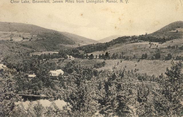
Beaverkill - Clear Lake ????
Fred: From the lookout above Clear Lake, looking
across the Beaverkill Valley. This portion of the valley, though little of it
can be seen, would be the present location of the newer portion of the
Beaverkill Campsite. The road traversing across the hillside in the center of
the image would be the road from the covered bridge [unseen and off on the
right] to the Berry Brook road [to the left], its valley which leads off into
the distance. The buildings along this road would either be. or
near, the present location of the Hammerstrum [sp] residence.
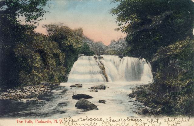
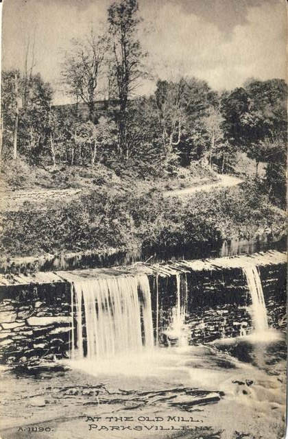
The falls at Parksville but I think there is a bit of creative artist at work
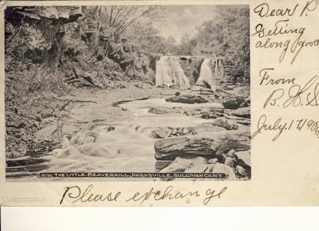
Same falls but no doctoring
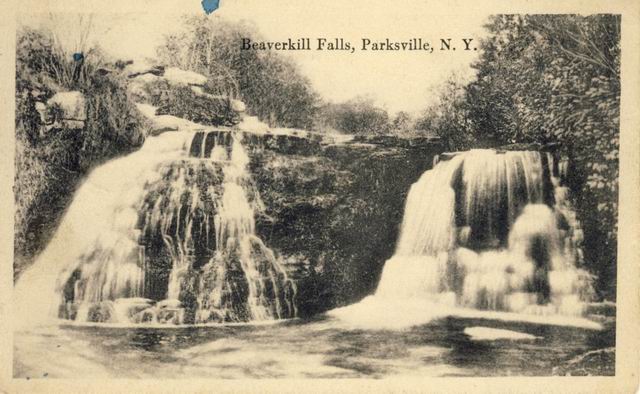
Sme Parksville falls but wather running on the side. May have been after the gistmill
This appears to be the raceway of the falls in Parksville on the way to the Gristmill shown in the next pix
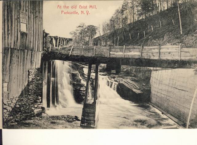
The falls in Parksville was the power for sawmills and gristmills
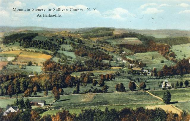
Overview of Parksville looking to the East?. Hard to believe all the fields
that were mowed and there
were so many farms. Not sure it is even Parksville. anyone???
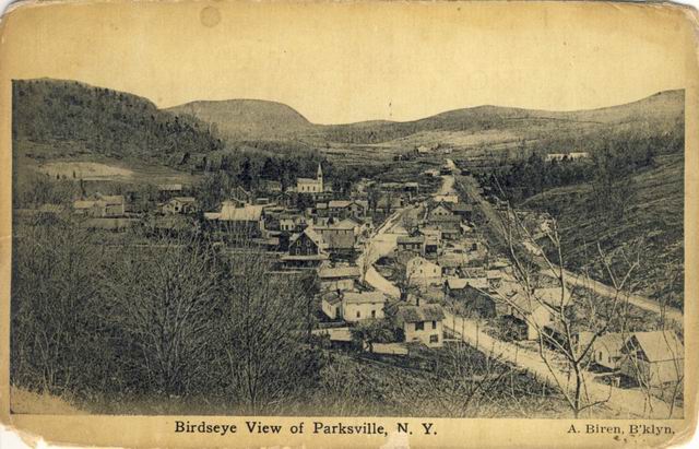
Parksville looking East. O&W tracks on the right and rt 17 through town in
the middle. Church in the center
still there today even though the town is a "ghost town"
Fred: Actually, the church is no longer located at
that location. Situated on the high ground next to the Methodist cemetery, the
remains of the foundation can still be seen at the rear of the cemetery.
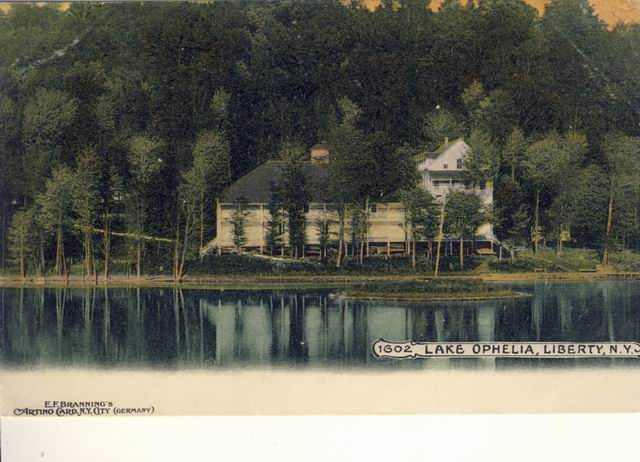
Lake Ophelia in Liberty. When Rt 17 bypass was built the lake was drained and
filled in. That was the
social center of Liberty for many events
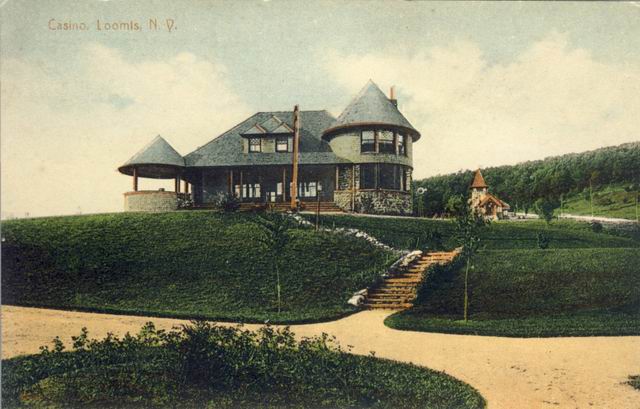
At one time Loomis was a TB recovery center with many buildings and activities as this Casino shows
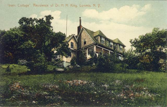
The TB Doctors house at Lookis
This doesnt look like Lake Ophelia but there were no other lakes in Liberty
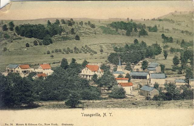
Youngsville in its prime. Looking South??
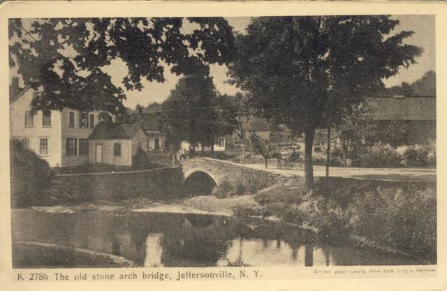
Jeffersonville bridge may still be there
Fred: This appears to be the location of where
Laundry Brook joins the Callicoon Creek. If that is the case, the highway would
be the present Main Street of Jeffersonville, Route 52. Laundry Brook created a
lot of damage during the recent storms of July 2014, washing out a bridge
upstream and ripping up back yards along its path. The barn on the right would
be what was [or is] Peter's auction barn.
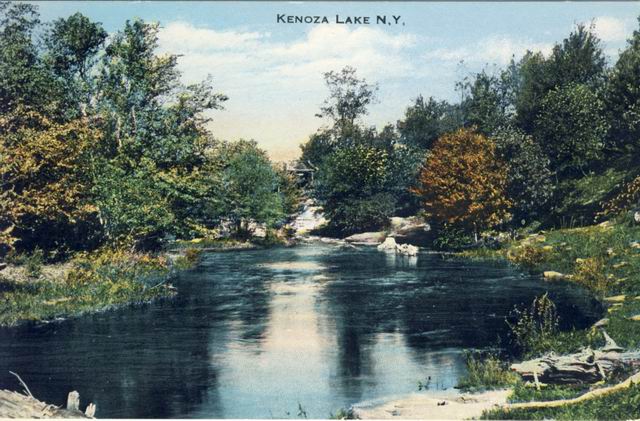
Doesn't look like the Kenoza Lake I know. May be the inlet
Nice
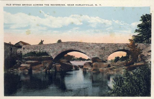
Bridge in Hurleyville. Not there today but looks like it would last like the Romans bridges
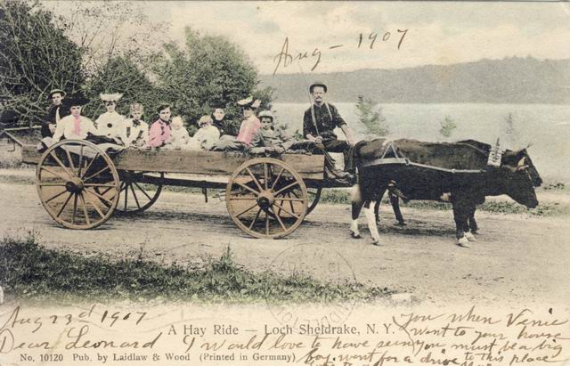
Hayride in Loch Sheldrake. Must have been on the way to gamble in all the hotels that were there
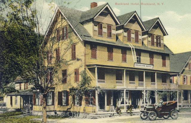
Roscoe - Rockland House. Seems the big building is not there and the current
Rockland house is the building
to the right. Anyone from Roscoe???
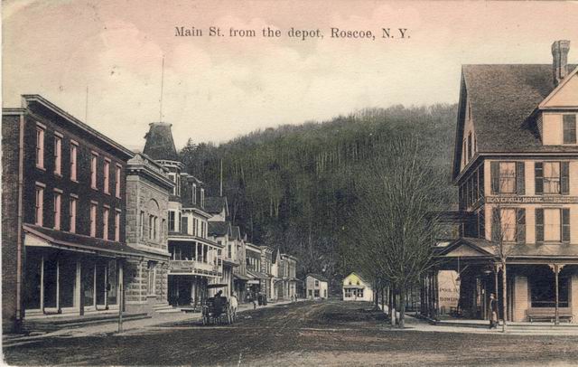
Main Street in roscoe looking North. Most buildings are there today
Fred: Actually, very few buildings seen in this image
still remain. The two buildings on the left, Kimble Sprague's and the concrete
block bank building, still remain, along with the building at the far end of the
street. Everything in between was wiped out in the fire of November, 1916.
Likewise the Beaverkill House, the building on the right.