.jpg)
by Fred Fies
I wound up with a box of film negatives from photographs taken by Harold Spriggs. I received them a while ago, but not having a scanner that could scan negative to positive, I wasn't able to do anything with them. I recently contacted Bill Cogswell, Town of Liberty historian, who has such a scanner that can convert negatives to positive photographs. He scanned a couple of dozen of the negatives; some from the Manor, and others from around the county.
1938 Flood
July 28, 1938 Livingston Manor Times
An evening
shower starting about 8 o’clock turned into a veritable deluge and by midnight
pavements and streets were under several inches of water. The Willowemoc,
Cattail and Little Beaver streams became raging torrents, eating their way
through solid masonry to leave buildings in a toppling and perilous condition,
undermining highways and bridge supports and washing huge gullies in county and
town roads.
The Cattail
stream, in dry season a mere trickle, was the highest in the memory of the
oldest inhabitant. Swollen with tributary brooks from the hillsides it pounded
menacingly against the town-county highway paralleling its banks washing out a
good half of the road-bed just west of the Manor, in the vicinity of the G H
Treyz chemical factory, where horses in the company’s stables were rescued with
difficulty. Men were roped to blindfold the frightened animals and lead them to
safety. The water was up to horses’ shoulders as they were led from their
stalls. Emergency docking was necessary on the Cattail road to hold it from
further washout by the roaring torrents, Friday.
Dredging of the
Willowemoc, opposite the Manor’s new $640,000 central school building
undoubtedly saved not only the handsome edifice now practically completed, but
surrounding territory as well. While water backing up from the Little Beaverkill
as that stream burst bounds Friday forenoon flooding Main and Pearl Streets to a
depth of approximately three feet, the high water mark here did not approach
that of other flood years. The widened Willowemoc took care of its torrents
nicely, the river at no time being less than eighteen inches from the bank and
at least three feet from the newly placed shellwork of the footbridge leading to
the Island on which the school building stands.
Fig.1 - Though no date is attributed with this Sprigg's negative,
this is probably a photograph of the flood that occurred in late July of 1938.
Treyz's acid factory is still in operation, though at the time at a limited
pace. World War Two saw the factory in full operations again, maintaining three
shifts of men. However, synthetic products produced at a lower cost soon
replaced the products made by this and other acid factories. Coupled with the
shortage of laborers due to the on-going war, the Treyz factory closed for good
and was dismantled in May of 1944.
.jpg)
Fig. 2 - This is the 1938 flood; check the license plate at the
lower left. The truck is Harry Adler's. Looks like Addie Shaver is surveying the
situation at the door of her restaurant.
.jpg)
Fig. 3 - Possibly the RT 17 bridge in Deckertown
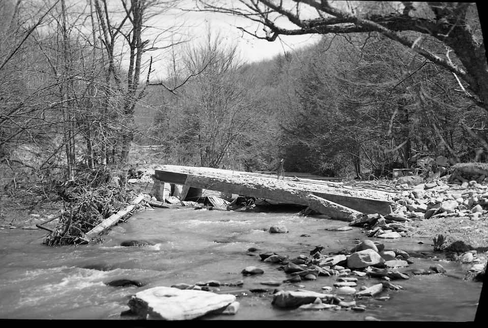
Fig. 3a - This appears to be the bridge on the Shandelee
Road, crossing over the Cattail Creek, after the flood of July, 1938.
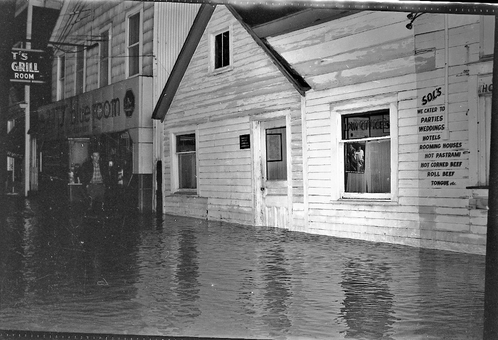
Fig. 4 - The same photograph of Main Street flooding. Notice the
corrugated metal on the side of the Blue Room. The building was originally
associated with Dawson's iron foundry. Known as the "sheet iron building," the
structure housed casts and molds used at the foundry next door.
No date. Presumably the same 1938 flood. The building
next to the Blue Room was at the time Harold Sprigg's law office.
 Fig. 5 -
Overview of Livingston Manor looking up the Willowemoc River Valley
Fig. 5 -
Overview of Livingston Manor looking up the Willowemoc River Valley
This was taken from the driveway leading to the old
Mayflower Hotel, located off of the Back Shandelee Road.
Both the Homer and Avery buildings are now in this
photograph, so it must have been taken in 1941 or later.
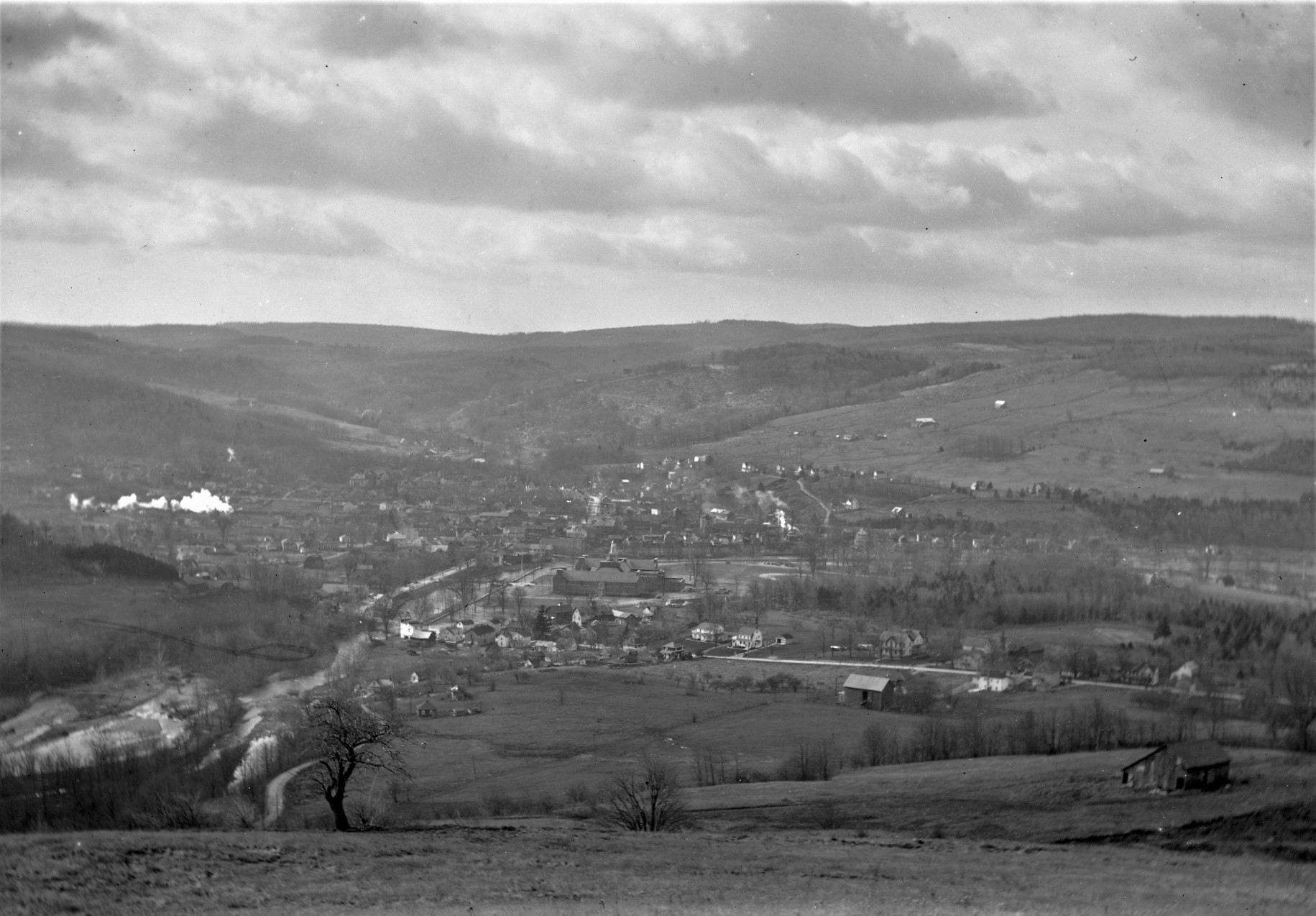
Fig. 6 - This photograph I was able to date, approximately. Irving
Avery's house, which was built during the year 1941, is not in the picture. More
importantly, Everard Homer's house is also not in the photograph. The Homer
residence, located on Meadow Street, was begun during the summer of 1939. Since
there are not many vehicles in the school parking lot, my guess is that this
photograph was taken during the spring of 1939, maybe around Eater time.

Fig. 7 -
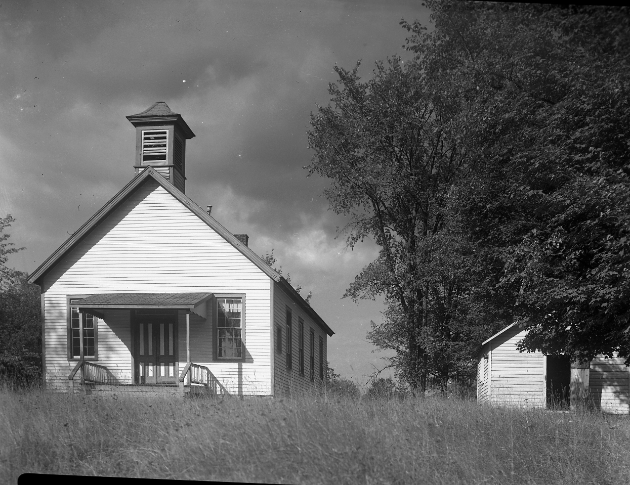
Fig. 8 -
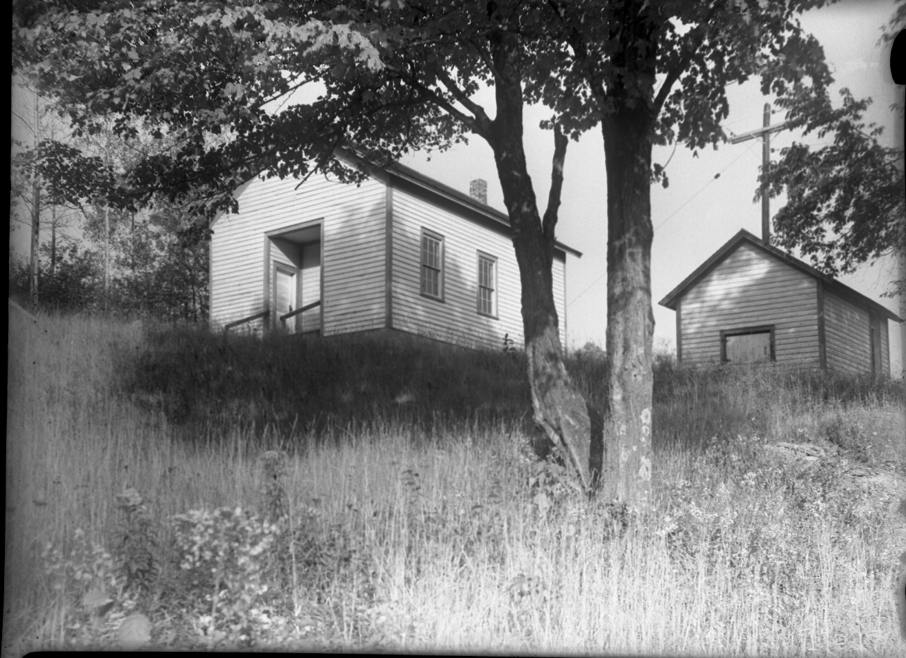
Fig. 9 - Beaverkill School; It was located what is now the county road between Deckertown and Lew Beach, across from junction with the Beaverkill Campsite Road. The building is gone and today a residence is located on the site.
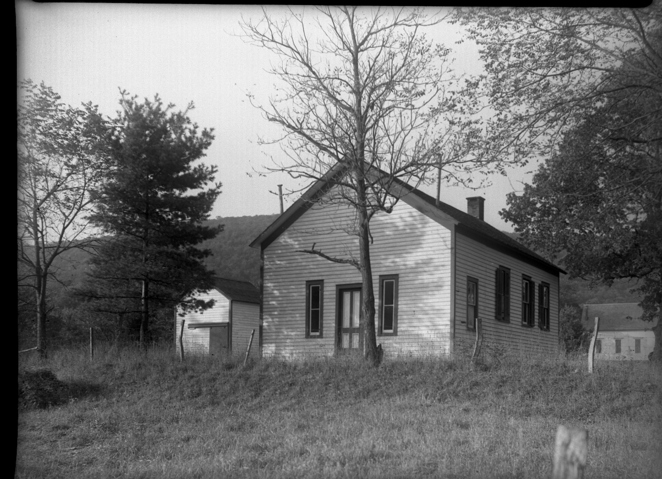
Fig. 10 - This may be the school at DeBruce. It was located off the county road leading to Willowemoc, between the junctions of the road leading to Brown Settlement and the road leading to the fish hatchery. There would need to be some verification as for the identification of this building to be certain of its location.
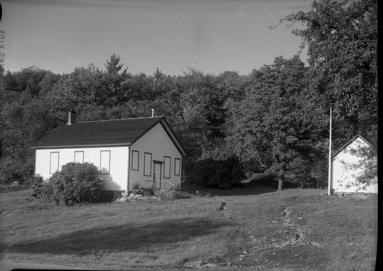
Fig. 11 -
Hazel School; this building still exists as a
residence, most recently the home of the late Doris Marks. Its located along Old
Route 17. There are no dates on the photographs. They seem to range
from 1939 to the mid fifties
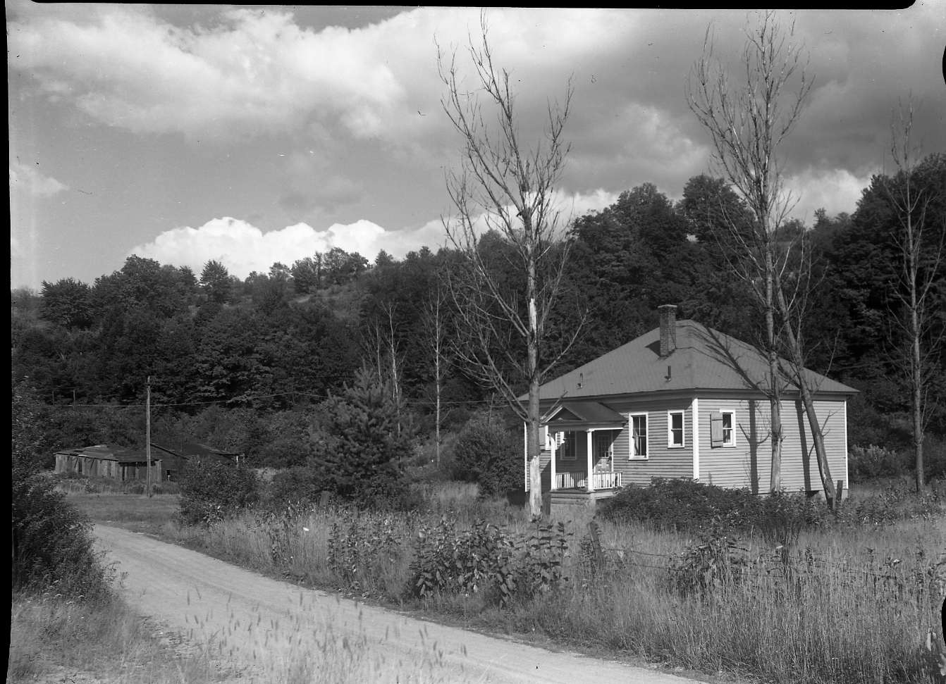
Fig. 12 - Old Morsston School. This building is also still in existence, and has also been converted into a residence
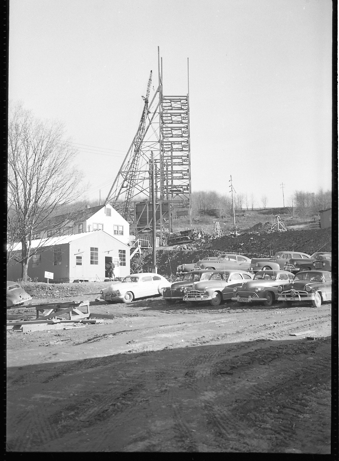
Fig. 13 - Shaft in DeBruce 1950. The photograph of the shaft is that of the shaft at DeBruce. Since this is the
tunnel that drained the Cannonsville Reservoir, the date would have to be the
mid to late 50's.
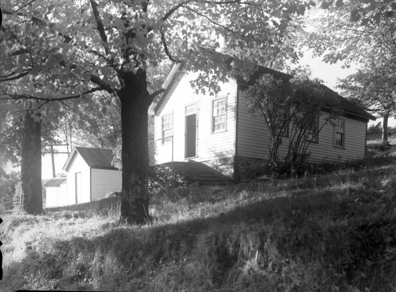
Fig. 14 - Parkston School House. Shows up on the 1875 Beers map and was part of the William Parks lot that became the Van Aken Homestead Farm at about 1900
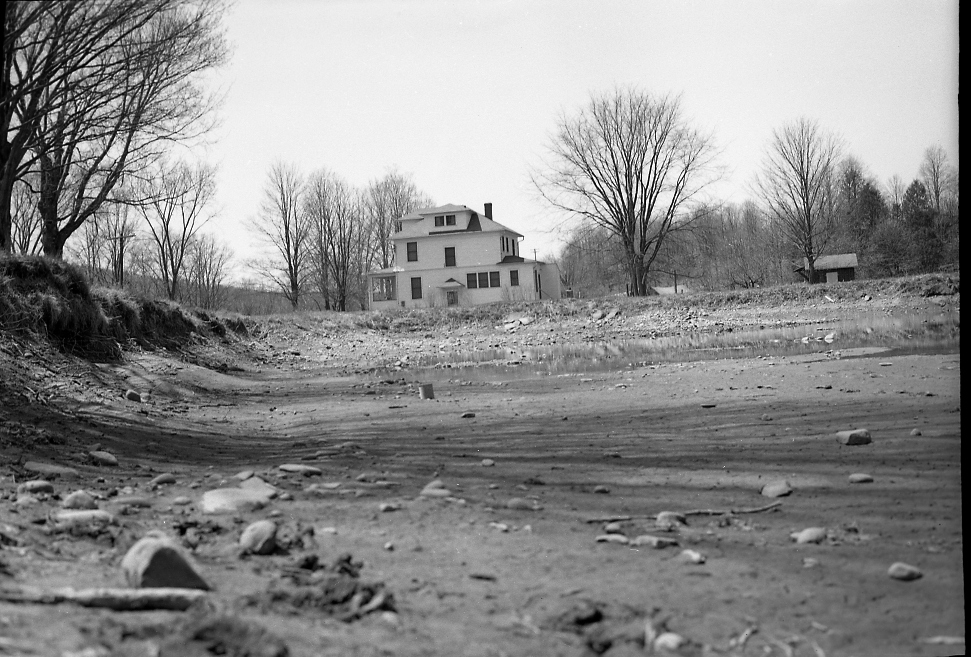
Fig. 15 - Hotel Capitol Pond that was the supply for the William Parks sawmill and turning mill in 1875. Later was enlarged for boating for the Hotel Capitol
Fig. 16 - Hotel Capitol pond showing the concrete wall that we used to fish for eels for my Granfather Wiley Lacey who lived next door
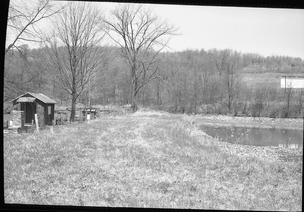
Fig. 17 - Hotel Capitol Pond with handball court in the back
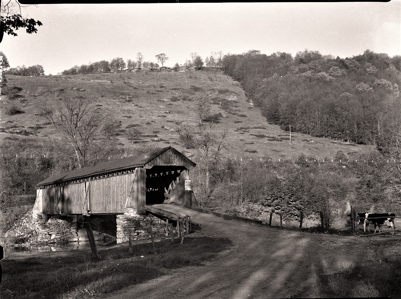
Fig. 18 - VanTran covered bridge
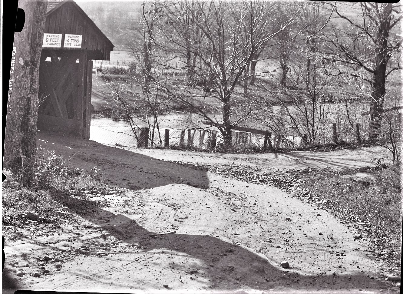
Fig. 19 - VanTran Covered Bridge - note the road went in both directions
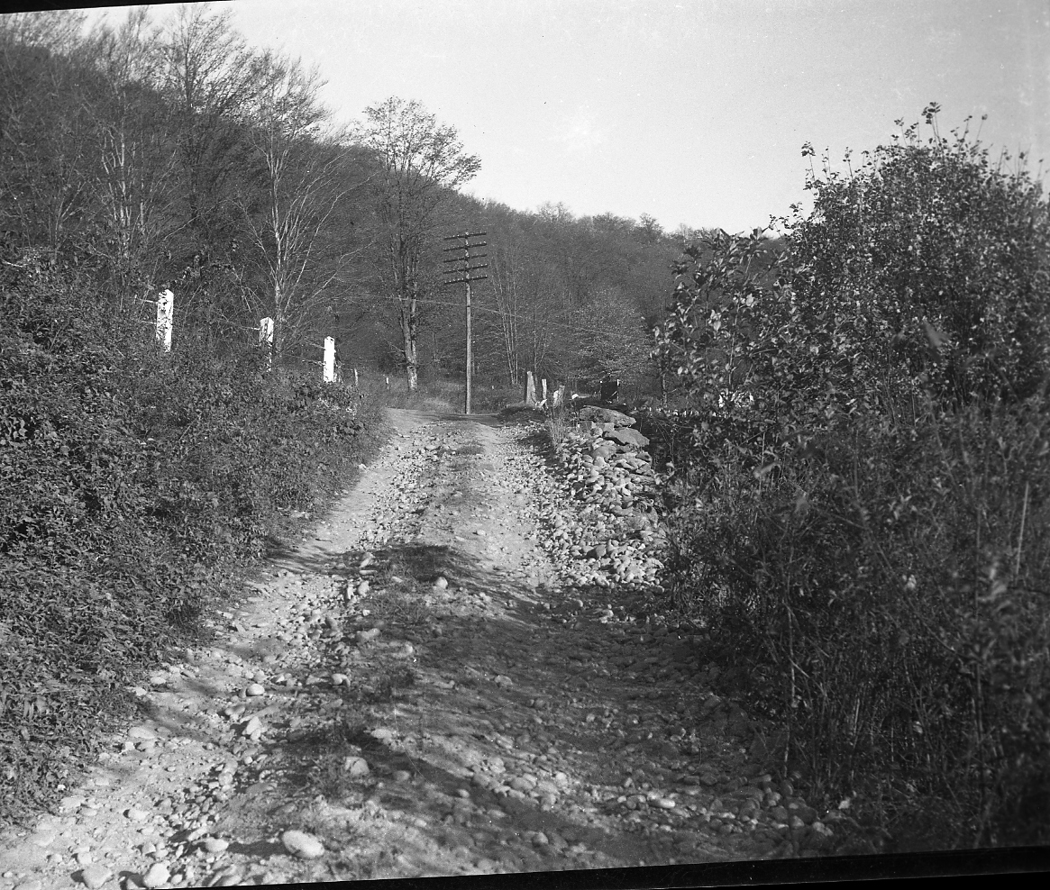
Fig. 20 - Exit from the covered bridge going towards Livingston Manor
.jpg)
Fig. 21 - These images show the original configuration of the Manor-Deckertown road, which made a junction with the access onto the Vantran Covered Bridge. The construction of Star Route No. 4 in 1913, later to become Route 17, bypassed the covered bridge access
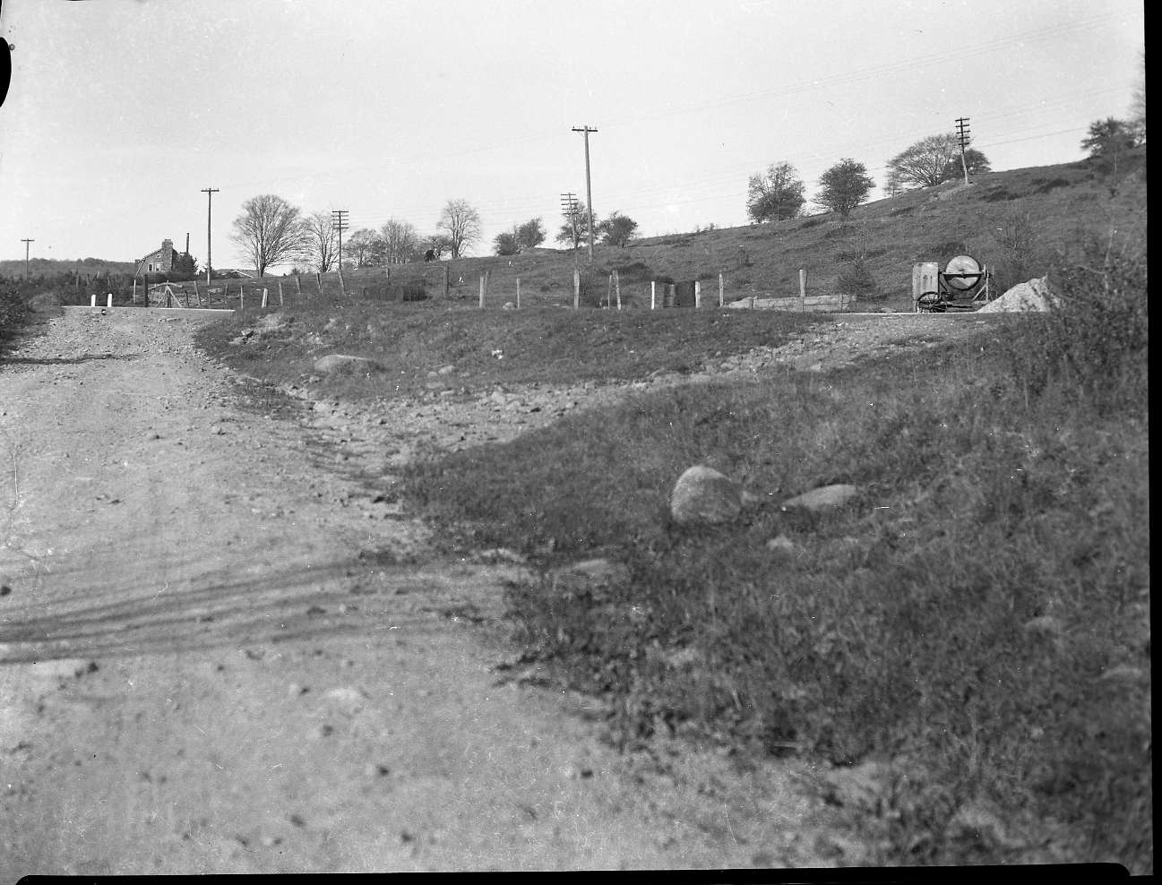
Fig. 22 - That's King's Catering House in the background.
To the right, along the highway, is a cement mixer along with a pile of sand. A
wooden form is to the left of the mixer. This may represent work being done on
the spring, or spring house, that came off of the hill and served the then
Silverman farm. Note how far from the road the telephone lines are.
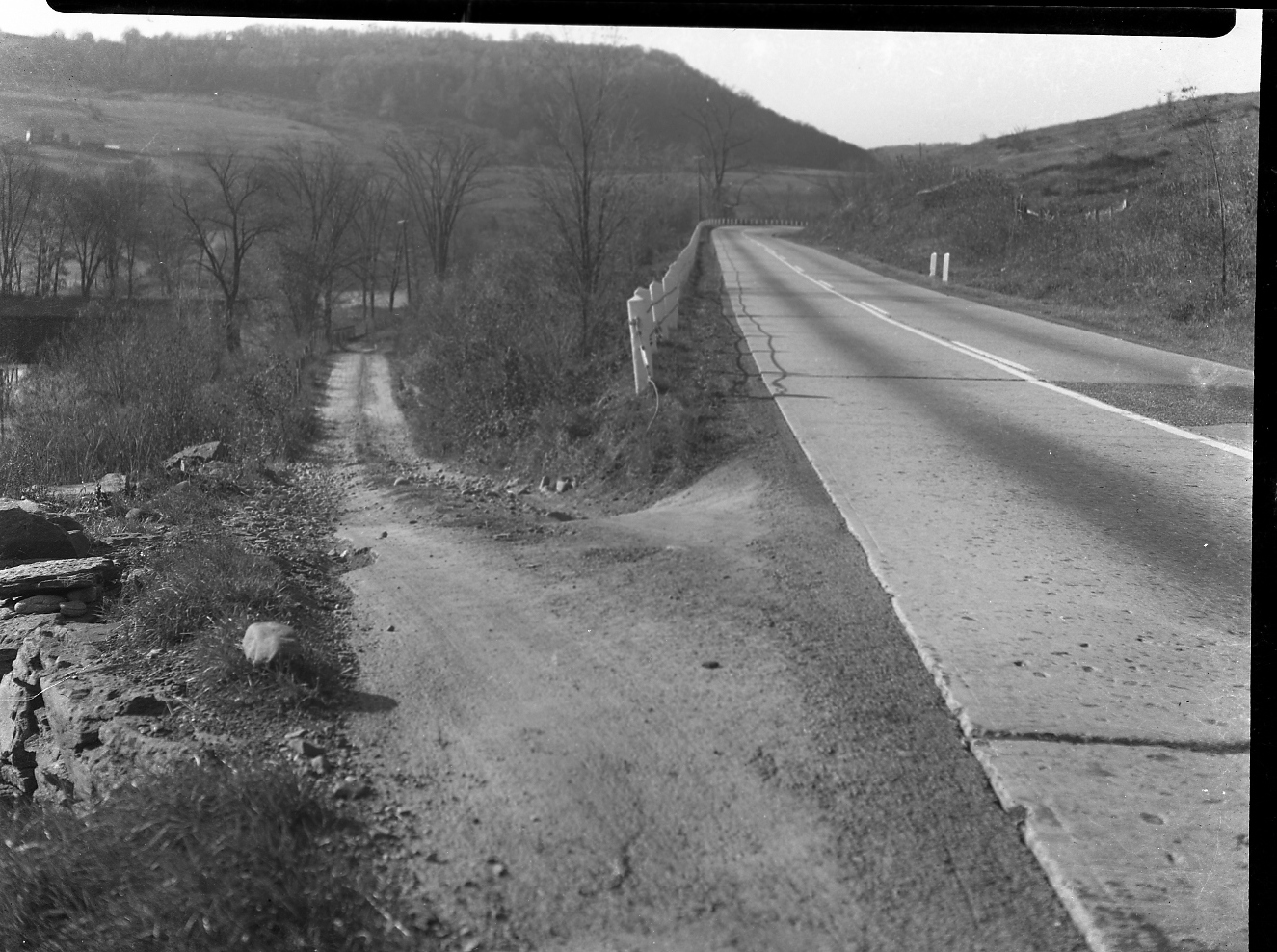
Fig 23 - Looking West with the Covered Bridge entrance from Route 17
+-.jpg)
Fig. 24 - Entering the Covered Bridge coming from Deckertown and Roscoe
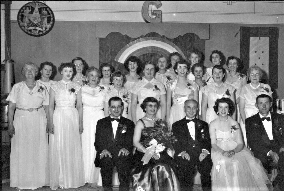
Fig 25 - photograph from Harold Spriggs showing a meeting of the local chapter of the Eastern Star. Gert Strudevant was able to identify about half the folks in the photo and says the photo was taken in 1954
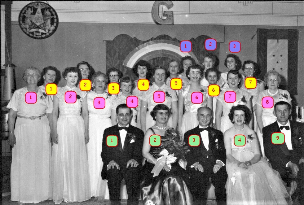
Fig. 26
Eastern Star – 1954
Front Row 5
2nd Row 8
3rd Row 7
Back Row 3
1
Leon Husch
?
?
2
?
Edith Knoll
Alma Roberts
3
Fannie Parrella
Schliermacher?
Mae Van Aken ?
4
Elizabeth Ackerly
Gert Sterdevant
Rita Fontana
5
George Winklestern {?] [Jeffersonville]
Doris Scudder
Helen Knipscher
6
Dot Withers
7
Francis Decker
8
Ruby Hartig
9
Helen Voorhees
Eastern Star – 1954
Front Row
1
Leon Husch
2
3
4
Elizabeth Ackerly
5
George Winklestern {?] [Jeffersonville]
Second Row
1
Greta Spriggs
2
Rita Fontana
3
Fannie Parrella
4
Gert Sterdevant
5
Zada Withere
6
Dot Withers
7
8
9
Helen Voorhees
Back Row
1
Elly Hoos
2
3
Edith Knoll
4
5
Helen Knipscher
6
7
Alma Roberts
8
9
Ruby Hartig